![]()
FREE INFORMATION - SHARED BY RESEARCHERS ON GAGENWEB PROJECT
Plat Maps
| Pre Ft Benning
| After Ft. Benning
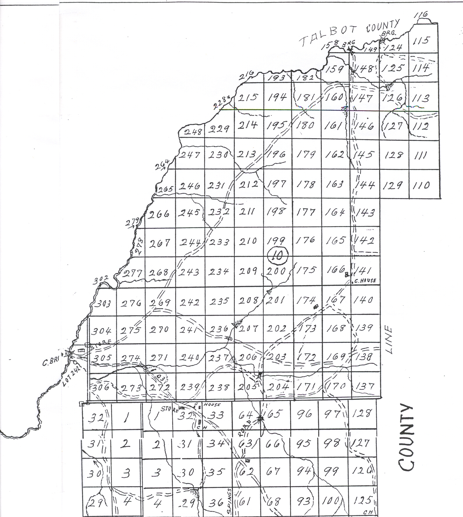
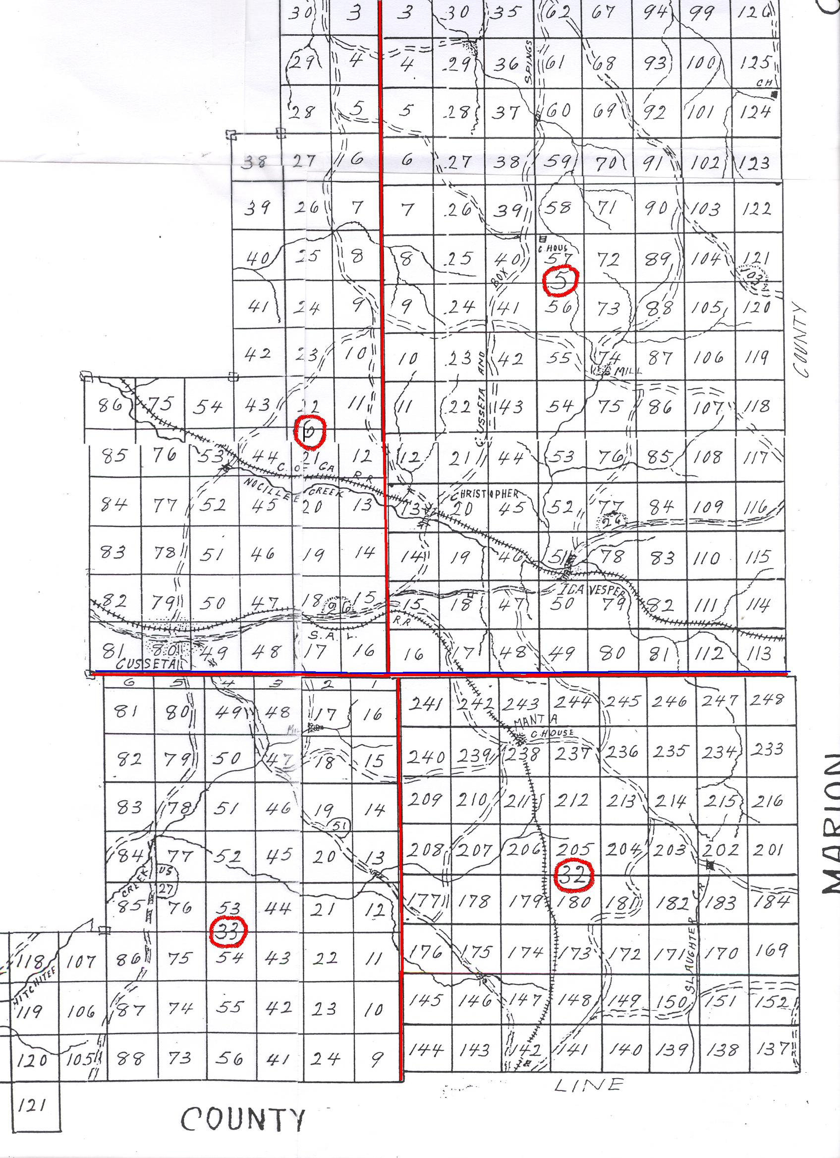
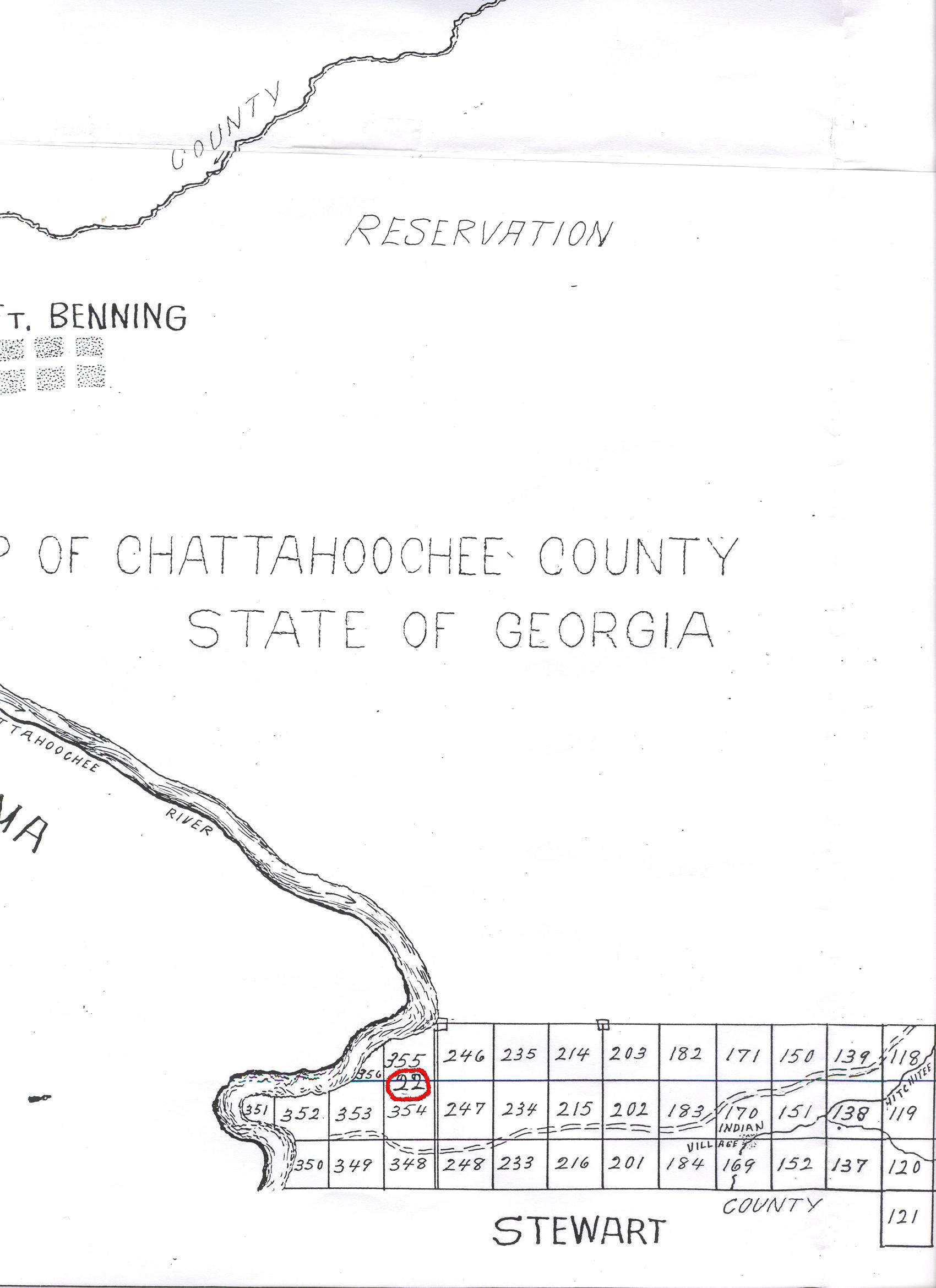
This map is marked J. H. AUSTIN, 1939. It shows the land lots and districts in private ownership between the establishment of Ft. Benning (ca. 1918) and the expansion during
the World War II era.
Click the PHOTO for Enlarged Picture
North East Section - Land Districts
10, 5 and 6
South East Section - Land Districts
5 & 6 (Original Muscogee) and 33 & 32 of Original Lee
South West Section - Fort Benning
and 22 of Original Lee
GAGenWebis part of the
USGenWeb Project. 
Send comments about GAGenWeb to, Adopt Me - , County Coordinator.
Page last updated: Tuesday, 24 October 2017 23:04 EST
Copyright, the GAGenWeb Project, 2005 - Present
All materials contained on these pages are furnished for the free use of those engaged researching their family origins. Any commercial use, or, other electronic posting of any files/pages without the consent of the host/author of these pages is prohibited. All images used on these pages were obtained from sources permitting free distribution, or generated by the author, and are subject to the same restrictions/permissions. All persons contributing material for posting on these pages does so in recognition of their free, non-commercial distribution, and further, is responsible to assure that no copyright is violated by their submission.