![]()
FREE INFORMATION - SHARED BY RESEARCHERS ON GAGENWEB PROJECT
Click the PHOTO for Enlarged Picture
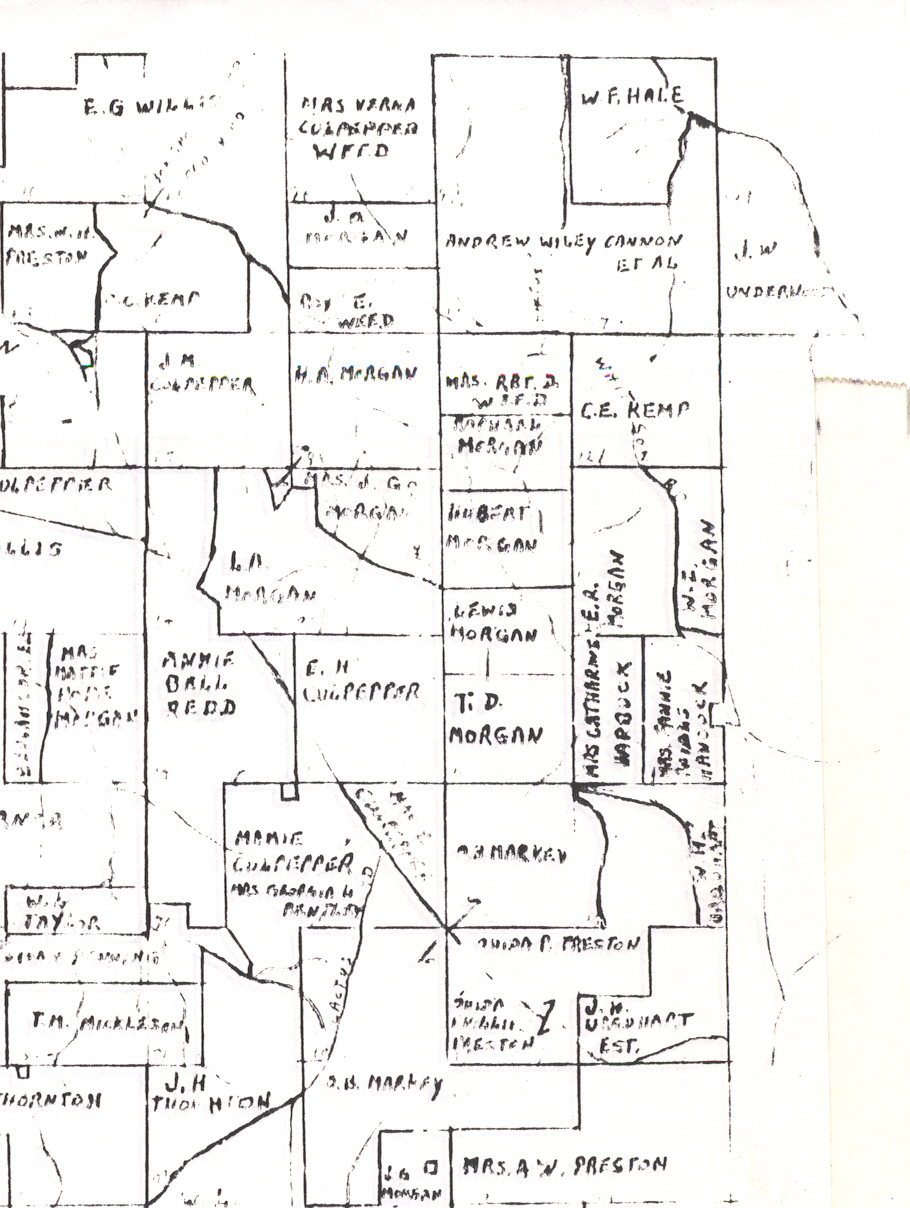
| North East Section- Land District 10, 5, 6 PLAT map |
|
| 
|
| 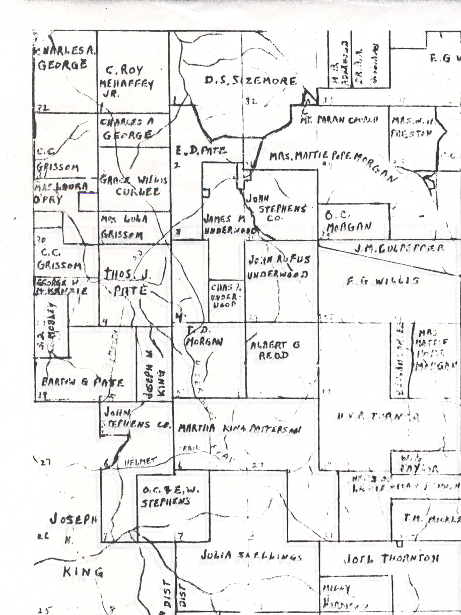 North West Section - Land District 6 |
|
| 
|
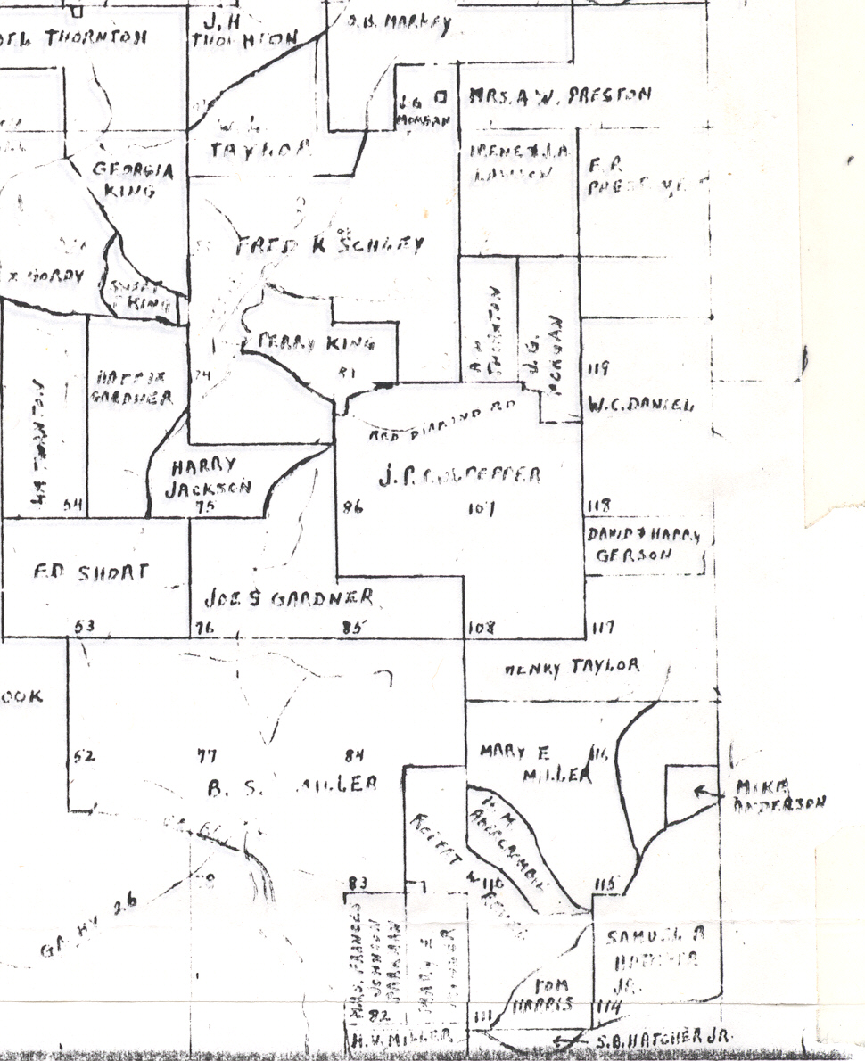
South East Section - Land District 6 & 5 (Original Muscogee) + 33 & 32 (Original Lee) |
|
| 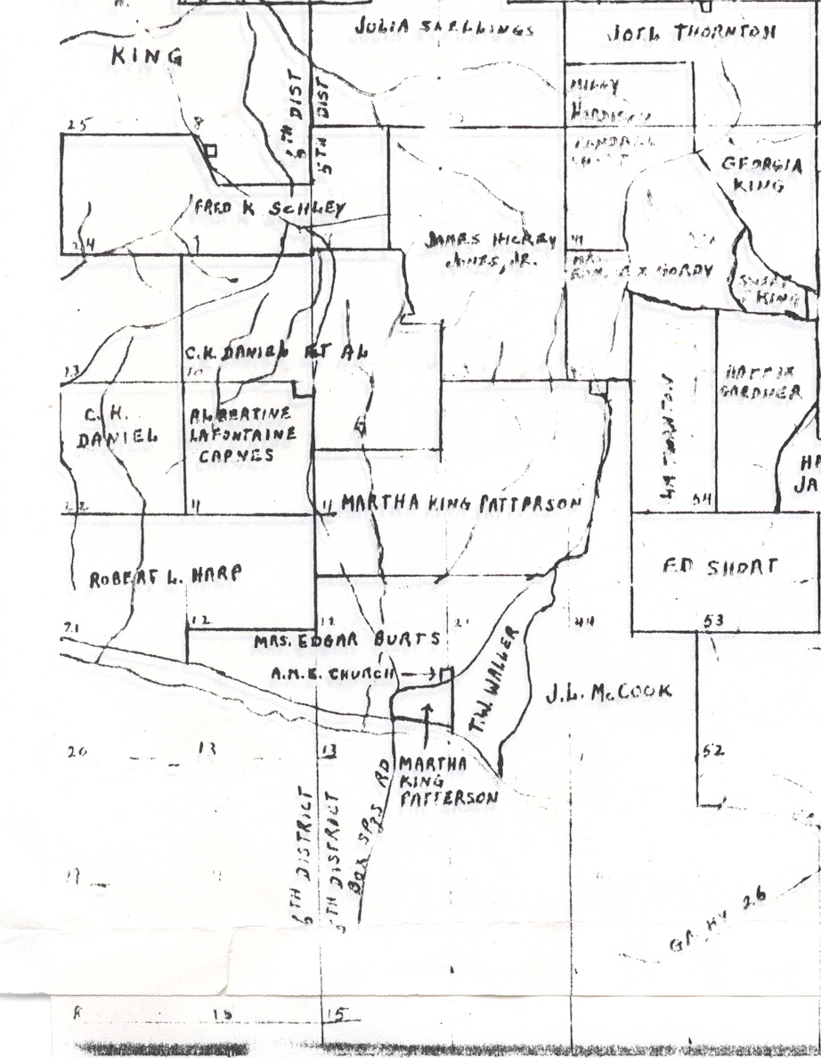 South West Section - Land District 6 & 5 (Original Muscogee) + 33 & 32 (Original Lee) | |
Many thanks to Mr. John Mallory Land who scanned these maps for our use!
GAGenWebis part of the
USGenWeb Project. 
Send comments about GAGenWeb to, Adopt Me - , County Coordinator.
Page last updated: Tuesday, 24 October 2017 23:04 EST
Copyright, the GAGenWeb Project, 2005 - Present
All materials contained on these pages are furnished for the free use of those engaged researching their family origins. Any commercial use, or, other electronic posting of any files/pages without the consent of the host/author of these pages is prohibited. All images used on these pages were obtained from sources permitting free distribution, or generated by the author, and are subject to the same restrictions/permissions. All persons contributing material for posting on these pages does so in recognition of their free, non-commercial distribution, and further, is responsible to assure that no copyright is violated by their submission.